Dear Friends,
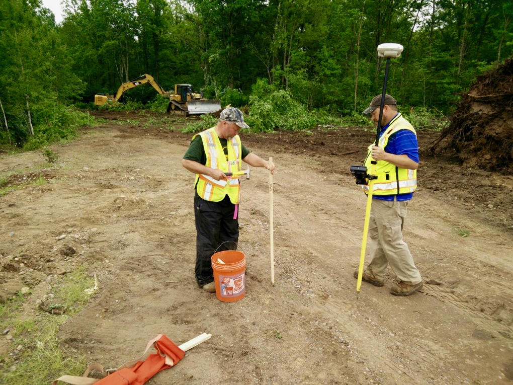
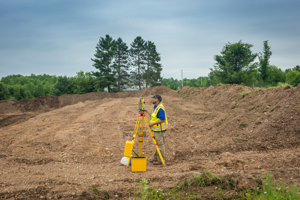
ISHA has hired Cooper Engineering of Rice Lake, Wisconsin to serve as our civil engineers for the Meeting Hall dome project. It is essential that all of the project design features be accurately located on the construction site. In addition to the buildings, this includes the roads, the sidewalks, the utility lines, the parking lot, the drainage, the erosion control measures, and much more. The photos below show how the Cooper Engineering experts can locate all of these features for our crew of earthworking sevadars.
In the first photo, surveyors are using a differential GPS (global positioning system) to precisely map the footprint of the kitchen/dining hall, which will be located at the bottom of ISHA Hill, near the parking lot. These GPS units use satellite signals to locate points with an accuracy of inches, or less!
In the second photo, the surveyor is using a total station or TST (total station theodolite) to lay out the dimensions of the parking lot. A total station is an electronic/optical instrument used in modern surveying and building construction. It combines the capabilities of an electronic theodolite (transit) with an electronic distance meter, to read slope distances from the instrument to a particular point with great accuracy.
All of the features of the project are marked with wooden stakes, which the excavators can then use as guides for their earthworks activities.
With warmest regards,
Paul Bauer
Chair of ISHA Building & Fund-Raising Committee